Planning an Australian road trip means two different jobs: deciding where you will stop and sleep, and getting from one stop to the next. No single app does both best. We make AussieCamps, and it is first here because it is built for the first job. Every app below was checked on 20 October 2026, with notes on when another one is the better pick. In the AussieCamps app you save campgrounds as stops, drag them into order and see the distance, date and weather for each one.
Quick comparison
Navigation apps are excellent at the drive itself and not designed to show where you can stay overnight. Most trip planners are the reverse. Most travellers use one of each, and the table shows where each app sits.
| App | Price (AUD) | Stops per trip | Without signal | Turn-by-turn navigation | Best for |
|---|---|---|---|---|---|
| AussieCamps | Free download; trips need the Pass (from A$2.99) | No stated limit | Place details on the phone | Hands off to Apple Maps or Google Maps | Planning nights, stops and dates |
| Google Maps | Free | Up to 9 stops including the destination | Downloaded areas, driving within them | Yes | Navigation and live traffic |
| Apple Maps | Free, built into iPhone | Up to 14 stops | Downloaded maps with directions | Yes | Navigation on iPhone |
| Wanderlog | Free; Pro plans listed from A$50.99 a year | Unlimited, per its listing | Trip plans offline with Pro | No | Itineraries mixing drives and city days |
| WikiCamps Australia | A$9.99 once per platform | Sections and places, no stated limit | Up to three downloaded trips | No | Camping trips with a fuel estimate |
| ExplorOz Traveller | A$59.99, offline map from A$59.99 a year | Route planning on tracks | Full Australian topo map with EOTopo access | Yes, on its own maps (routes calculated online, then usable offline) | Remote and 4WD routes |
1. AussieCamps: plan where you will stop and sleep
AussieCamps treats a trip as a list of places rather than a line on a map. You add campgrounds, caravan parks, rest areas or any saved place as stops, put them in order, and see the driving distance and time for each leg and for the whole journey. Each stop can carry an arrival date, and the app shows the forecast for arrival dates within the forecast range, which is the detail that changes plans most often in Australia.
Around the route it keeps a trip checklist and packing list, notes, a cover photo, and visited progress as you go. A trip can be shared or synced to your calendar with its stops and dates. Because the place directory lives on the phone, details for every stop stay readable out of signal, while the map, directions and forecasts need a connection. When it is time to drive, directions open in Apple Maps or Google Maps.
The download is free, as are bookable hotels, motels, B&Bs, holiday parks and tours from BookEasy. Trips, collections and the campground, rest area and dump point data need the AussieCamps Pass, sold as a weekly subscription or a one-off lifetime purchase, with in-app purchases listed at A$2.99 to A$9.99 on the Australian App Store.
Choose something else if you need turn-by-turn navigation inside the planner, if you are on Android, or if your trip is mostly cities, where a general itinerary app fits better.
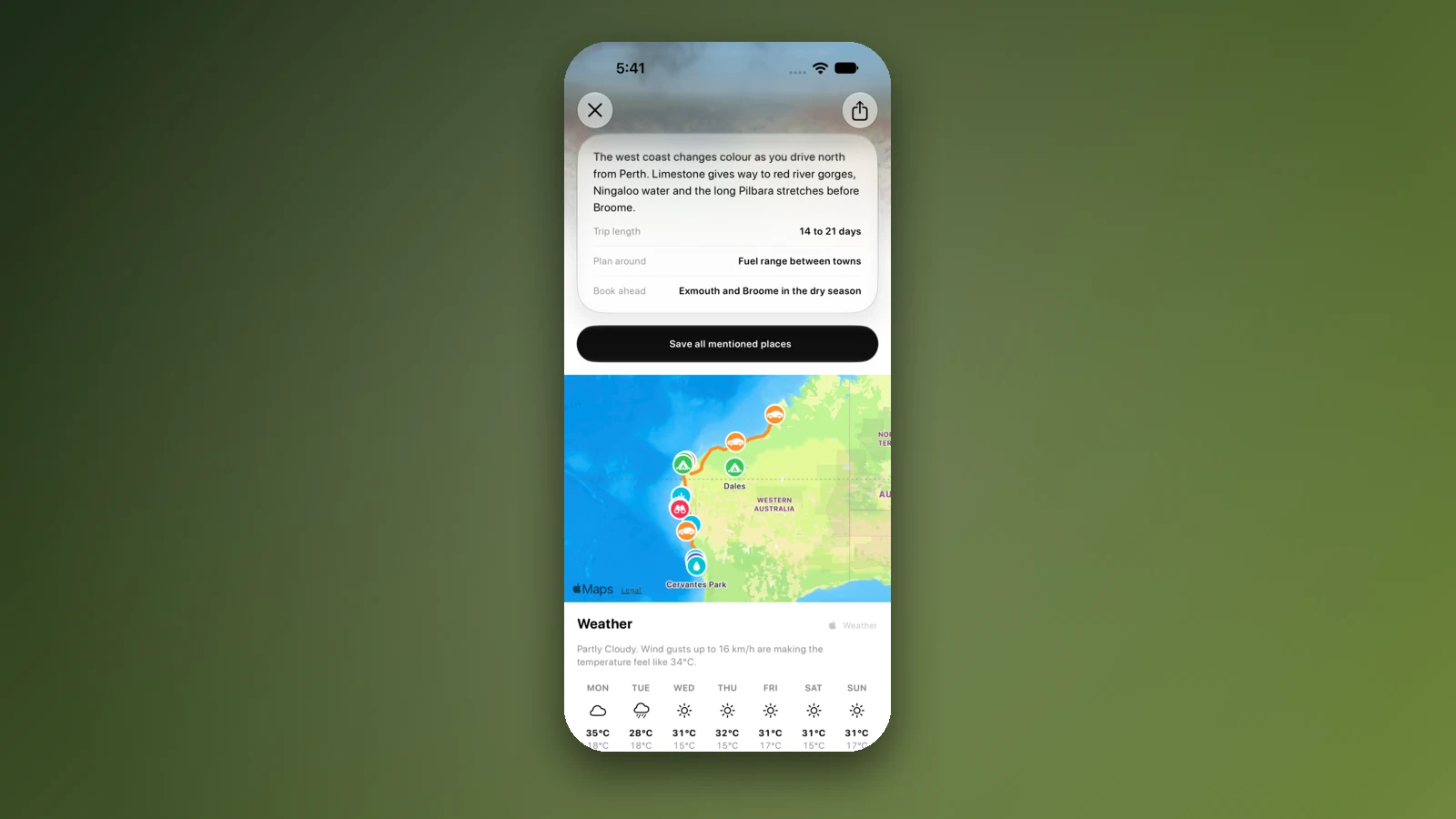
- Stops, dates and forecasts in one plan
- Trips need the Pass
- Navigation hands off to Apple or Google Maps
2. Google Maps: the navigator most people already have
Google Maps is free, covers Australia well and gives live traffic and turn-by-turn directions. For planning, it allows up to 9 stops on a route, counting the final destination, which is enough for a day's drive but not for a two-week loop, so long trips end up split across several routes or saved lists.
Download the areas you will drive through before you leave. Google's help pages say offline driving directions work only when the whole route is inside a downloaded area, offline maps expire unless updated, and traffic is not available offline.
- Up to 9 stops per route
- Download areas before remote legs
- Live traffic needs signal
3. Apple Maps: the iPhone default, with more stops
Apple Maps is built into every iPhone and its support guide allows a multi-stop driving route with up to 14 stops, which goes further than Google Maps for a single route. Offline maps can be downloaded, and Apple says they support turn-by-turn driving directions without a connection.
Apple notes that offline maps are not available in every country or region, so download a test area before you rely on it. Like Google Maps, it plans the drive rather than the nights: it will not tell you which rest areas allow an overnight stop.
- Up to 14 stops
- Offline turn-by-turn after download
- Apple devices only
4. Wanderlog: an itinerary builder for mixed trips
Wanderlog is a general travel planner with a 4.9 rating from more than 5,000 Australian ratings. Its App Store listing says you can add unlimited stops for free and see times and distances between places, which suits a trip that mixes drives with days in Sydney or Melbourne and flights between.
Its help centre, though not its store listing, lists offline access to trip plans and route optimisation as Pro features. The Australian App Store lists several Pro prices, from A$50.99 to A$99.99 a year and A$25.99 a month, so check the price shown to you. It has no dedicated camping or rest area directory and no in-app navigation.
- Free planning with unlimited stops
- Offline needs Pro
- Not built for camping stops
5. WikiCamps Australia: trip planning inside a camping app
WikiCamps includes a Trip Planner: you create a trip, add sections such as regions or days, then places and notes, and drag a progress bar as you travel. Enter your vehicle's fuel use and a price per litre and it estimates fuel use and cost between the places in your trip.
It costs A$9.99 once per platform, and up to three planned trips can be downloaded for use without signal. Its help pages do not mention drive times per leg, so pair it with a navigation app for timings.
- Fuel cost estimate between places
- Three trips offline
- A$9.99 once per platform
6. ExplorOz Traveller: route planning off the bitumen
For outback and 4WD trips, ExplorOz Traveller plans and navigates on its own EOTopo topographic map, which shows named roads and 4WD tracks, with track access notes. With EOTopo access downloaded, it works across Australia with no signal.
The app is A$59.99, and offline use needs EOTopo at A$59.99 a year, the 2026 edition at A$79.99 for four years, or Pro Access at A$99.99 a year. That is far more than a sealed-road trip needs, and exactly what a Simpson Desert crossing does.
- Navigates on 4WD tracks
- Offline topo map with EOTopo access
- Highest upfront price here (A$59.99)
Also worth knowing
TripIt organises bookings rather than routes: forward confirmation emails and it builds an itinerary with flights, hire cars and accommodation, available offline. Polarsteps plans and then tracks your route automatically, which suits travellers who want a record of the trip as much as a plan.
We left out Roadtrippers, a popular planner in North America, because its App Store listing says it is designed for road trips in the USA and Canada only.
- TripIt for bookings
- Polarsteps for tracking
- Roadtrippers is USA and Canada only
How we compared them
Each app's price, in-app purchases, rating and limits were checked on the Australian App Store and in the developer's own help pages on 20 October 2026. Stop limits are the ones the developers publish. We looked at what matters on an Australian road trip: how far apart the stops are, whether you can see where to sleep, and what still works out of signal.
Our own app earns its money from the Pass, and none of the others paid for a place here. Tell us through the support page if anything has changed.
- Checked on 20 October 2026
- Published limits only
- Corrections welcome
Places along the way
Check before you go
Rules and conditions change. Recheck the official source and the page for your exact park or campground before departure.
Common questions
What is the best app to plan a road trip in Australia?+
Use two kinds of app. A planner such as AussieCamps decides the stops, nights and dates, with distance and drive time for each leg, and a navigation app such as Google Maps or Apple Maps handles the drive itself. For remote 4WD tracks, ExplorOz Traveller does both on its own maps.
How many stops can you add in Google Maps?+
Up to 9 stops on one route, counting the final destination, according to Google's help pages. Apple Maps allows up to 14 stops on a driving route. Longer trips need splitting into several routes or a dedicated trip planner.
Does Roadtrippers work in Australia?+
Its App Store listing says it is designed for road trips in the USA and Canada only, so it is not a good fit for Australia.
Can I plan a road trip offline in Australia?+
Partly. Google Maps and Apple Maps can navigate within downloaded areas, AussieCamps keeps place details on the phone with the Pass, and WikiCamps keeps up to three downloaded trips. Live traffic, forecasts and new routes still need signal in most apps.
Take it on the road
Save the stops. Plan the whole trip.
Build an ordered route from saved places, calculate the distance and keep dates, notes and to-dos attached.