Brisbane to Cairns is about 1,700 km and 22 hours of driving on the Bruce Highway, by OSRM routing, which five legs of 300 to 400 km keep to about five hours a day. The only inland alternative leaves the Bruce at Rockhampton and adds about 245 km, and the cyclone and flood season from November to April matters more than the route.
Brisbane to Cairns routes compared
The Bruce Highway is the route almost everyone drives. Wikipedia gives it as about 1,679 km, entirely sealed, dual carriageway from Brisbane to Curra, where the Gympie bypass opened on 15 October 2024, and mostly two lanes north of there. The limit is 110 km/h from Caboolture to Curra, generally 100 km/h between Maryborough and Rockhampton, and lower through towns such as Childers, Gin Gin and Miriam Vale. It runs through Gympie, Bundaberg, Gladstone, Rockhampton, Mackay, Bowen, Townsville, Ingham and Innisfail to Cairns.
The inland variant leaves the Bruce at Rockhampton, takes the Capricorn Highway to Emerald, the Gregory Highway to Clermont and the Gregory Developmental Road to Charters Towers, then the Flinders Highway to Townsville and the Bruce on to Cairns. Wikipedia says the Gregory route is used by many road trains, and none of the sources checked says how much of it is sealed, so this guide does not call it a fast road. OSRM routing on OpenStreetMap data supplied the distances and times here, computed on 21 October 2026 for a car that does not stop.
| Route | Distance | Drive time | Road | Best for |
|---|---|---|---|---|
| Bruce Highway the whole way | About 1,693 km (Wikipedia: about 1,679 km) | About 21 h 57 min | Sealed, dual to Curra, mostly two lanes north | The standard drive, in five days |
| Bruce to Rockhampton, then Emerald, Clermont and Charters Towers to Townsville, then the Bruce | About 1,938 km | About 26 h 4 min | Capricorn and Gregory Highways, then the Gregory Developmental Road | Drivers who want an inland detour and have a spare day |
- Bruce Highway: sealed all the way
- Inland variant: about 245 km longer
- Inland: road trains, check conditions
Five daily legs
By OSRM routing, five legs keep each day to about five hours of driving. Brisbane to Bundaberg is about 362 km (4 h 42 min), Bundaberg to Rockhampton about 294 km (4 h 1 min), Rockhampton to Mackay about 335 km (4 h 16 min), Mackay to Townsville about 396 km (5 h 17 min) and Townsville to Cairns about 347 km (4 h 45 min). The longest of those, Mackay to Townsville, passes Proserpine and Bowen.
The camping and sights on this road are already in the Brisbane to Cape Tribulation guide and the Sydney to Cairns guide, so this guide does not repeat them. The AussieCamps data lists Queensland Parks and Wildlife campgrounds close to the route at Wongi Waterholes near Maryborough, Alligator Creek at Mount Elliot near Townsville, Big Crystal Creek in the Mount Spec section and Jourama Falls near Ingham. Fees are not in the data, so check the camping rules guide for Queensland and book through the park agency.
- Bundaberg about 362 km
- Rockhampton about 656 km
- Mackay about 991 km
- Townsville about 1,387 km
Wet season, floods and cyclones
Get Ready Queensland says the state's cyclone season officially runs from 1 November to 30 April, and cyclones can occur at other times. A Queensland road closure document, as shown in a search extract, says that during the Wet, from November to April, areas across Queensland can have flooding and landslips. Wikipedia says the Bruce Highway is prone to frequent flooding in a number of places, and that the Goorganga Plains south of Proserpine can be closed for days.
Transport and Main Roads, in a project page extract, says flooding closes the Bruce Highway at one or more places on the 16 km between Ingham and Innisfail about every two years in the wet season, often more than once, and the Gairloch floodway usually closes first. No source checked shows a closure for today, so check QLDTraffic and do not drive through floodwater. If your dates fall between November and April, keep a spare day in the plan.
- Cyclone season: 1 November to 30 April
- Ingham to Innisfail floods in most wet seasons
- Allow a spare day
Fatigue, rest stops and dump points
Queensland guidance in police and Transport and Main Roads statements is to take a break every two hours at a rest area or Driver Reviver site. The same extracts say to stop if you are drowsy, find it hard to keep your head up or cannot remember the last few minutes of driving. Some Driver Reviver sites are being handed to local councils or closed while staying open as rest areas, so use QLDTraffic, which lists rest areas and heavy vehicle rest areas, rather than a site list from an old guide.
The AussieCamps data lists one rest area in the corridor, Babinda rest area north of Innisfail, with toilets, drinking water, a shelter and picnic tables. That is a gap in the data, not a count of rest areas on the Bruce. The road trip fatigue and wildlife guide covers dusk and dawn driving, and the guide on overnight stays covers whether you can sleep at a rest area.
The AussieCamps data lists dump points at Wyllie Park in Petrie, Alf Larson Lions Park in Miriam Vale, the Tourist Information Centre in Curtis Park at Allenstown near Rockhampton, Cedric Archer Park in Gracemere, Railway Square in Sarina, Bluewater Park at Bluewater and the Hinchinbrook Visitor Information Centre in Ingham. Wyllie Park, Curtis Park, Cedric Archer Park and Bluewater Park list a washout tap. That is only the data's coverage, and QLDTraffic also has a dump point layer, so check the dump points guide and the map before a long leg.
- Break every two hours
- Stop if you are drowsy
- Use QLDTraffic for rest areas
- Dump points: Petrie, Rockhampton and Bluewater list a washout tap
Fuel and services
No road authority or operator source checked gives a fuel gap on the Bruce Highway, so no figure should be taken from the OSRM legs, which show only the distance between the towns used as waypoints. The longest of those is Rockhampton to Mackay at about 335 km, and it passes through towns, so fill up in the larger centres such as Gympie, Bundaberg, Gladstone, Rockhampton, Mackay, Proserpine, Townsville and Ingham rather than running low. On the inland variant, Clermont to Charters Towers is about 391 km with no waypoint between, which is distance only and not a confirmed fuel gap, so ask in Clermont and fill up there. Use the road trip fuel guide to budget fuel for that distance.
- Fill up in the larger towns
- Inland: fill up in Clermont
- Do not run low between centres
Road conditions, QLDTraffic and tolls
QLDTraffic, from Transport and Main Roads, shows traffic alerts for crashes, hazards, flooding and roadworks, flood cameras, rest areas, dump points, truck restrictions and the BOM rain radar. A Queensland Government extract gives 13 19 40 as its phone line. Check it each morning, and again at midday in the wet season.
The sources checked do not describe a toll on the Bruce Highway north of Brisbane. Whether your route out of Brisbane uses a Brisbane toll road depends on where you start, so check the operator before you leave.
- QLDTraffic: alerts and flood cameras
- 13 19 40 for road information
- Check each morning
Fire ants when leaving Brisbane
Queensland's fire ant biosecurity zones were updated from 15 April 2026 and cover parts of the Logan, Gold Coast, Moreton Bay, Lockyer Valley, Scenic Rim and Sunshine Coast council areas. The Biosecurity Regulation 2016 sets procedures for moving or storing fire ant carriers from within the zones, and a biosecurity instrument permit is needed if you cannot meet them. A summary of the zones lists baled hay or straw, manure, mulch, potted plants, quarry and mining materials, soil and turf as carriers, and says ants can hitch a ride in equipment or materials that have been in contact with soil or stored outdoors.
The search extracts do not mention caravans, campervans or camping gear, and the fireants.org.au pages block scripts, so this guide cannot say how the controls apply to them. Zones are reviewed monthly, so check the zone map and movement rules on fireants.org.au for the suburb you start from.
- Zones change monthly
- Soil, mulch, hay, turf, potted plants: carriers
- Check the map for your suburb
Plan the Brisbane to Cairns drive in AussieCamps
Plan it as a trip in AussieCamps: add the five overnight stops in order, and it shows the distance and drive time of each leg with a forecast for the day you plan to arrive. AussieCamps lists 1,838 campgrounds, 5,552 rest areas and 1,393 dump points from park agencies, road authorities and public datasets, and a place page shows the facilities, rules and RV sites those sources publish, as on the Cape Hillsborough National Park page near Mackay.
With no signal, place details, saved places and guides still open on the phone. Map tiles, routing, weather and photos need a connection, so open the trip before you leave town. AussieCamps is an iPhone app, free to download, with in-app purchases.
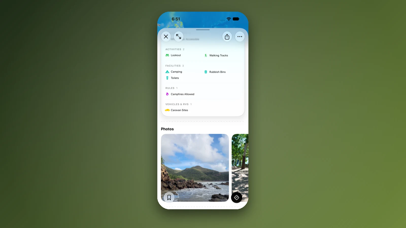
- Add each overnight stop in order
- Forecast per arrival day
- Open the trip before a long leg
Places along the way
Check before you go
Rules and conditions change. Recheck the official source and the page for your exact park or campground before departure.
- OSRM routing on OpenStreetMap data (Brisbane to Cairns, computed 21 October 2026)
- Wikipedia: Bruce Highway
- Wikipedia: Capricorn Highway
- Wikipedia: Gregory Developmental Road
- QLDTraffic
- Get Ready Queensland: cyclone and storm surge
- Bureau of Meteorology: Australian tropical cyclone season monitoring
- Transport and Main Roads: Bruce Highway (Ingham to Innisfail), Gairloch Floodway
- Queensland Government: Driver Reviver sites undergoing changes
- Queensland Fire Ant Program: moving materials
- Queensland Government open data: fire ant biosecurity zones
- FINIA: red imported fire ants biosecurity zone changes (10 May 2026)
Common questions
How long does it take to drive from Brisbane to Cairns?+
About 1,700 km and 22 hours of driving on the Bruce Highway, by OSRM routing on OpenStreetMap data (1,693 km and 21 h 57 min direct). Wikipedia gives the Bruce Highway as about 1,679 km. Five legs of about 300 to 400 km keep each day to about five hours of driving.
Is there an inland route from Brisbane to Cairns?+
Only a variant. You can leave the Bruce at Rockhampton, take the Capricorn Highway to Emerald, then the Gregory Highway and Gregory Developmental Road through Clermont to Charters Towers and the Flinders Highway to Townsville. By OSRM it is about 1,938 km, roughly 245 km longer than the Bruce, and Wikipedia says the Gregory route is used by many road trains.
When is the Bruce Highway most likely to flood?+
Queensland's cyclone season officially runs from 1 November to 30 April, and a Queensland road closure document says the Wet runs from November to April. Wikipedia says the Bruce is prone to frequent flooding, and a Transport and Main Roads extract says the 16 km between Ingham and Innisfail closes in most wet seasons. Check QLDTraffic before each leg.
Are there fire ant rules when driving out of Brisbane?+
Queensland's fire ant biosecurity zones cover parts of Logan, Gold Coast, Moreton Bay, Lockyer Valley, Scenic Rim and Sunshine Coast council areas. The rules control moving carriers such as soil, mulch, hay, manure, potted plants, turf and quarry materials out of the zones. The sources checked do not mention caravans or camping gear, so check fireants.org.au before you leave.
Places to camp in Queensland


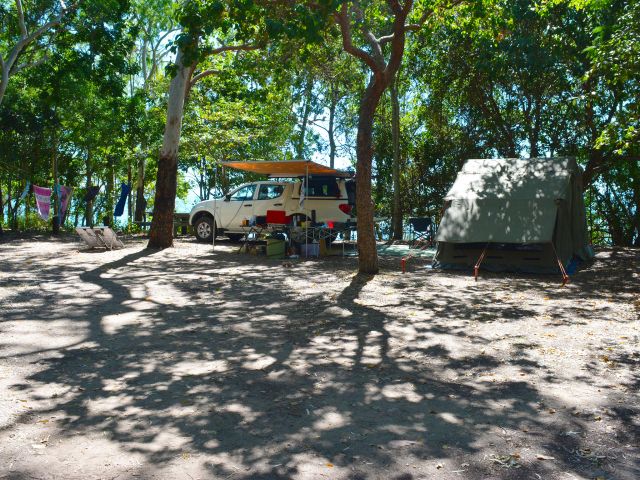


Take it on the road
Save the stops. Plan the whole trip.
Build an ordered route from saved places, calculate the distance and keep dates, notes and to-dos attached.